Aneurin Bevan Memorial Stones
Introduction
The photograph on this page of Aneurin Bevan Memorial Stones by Robin Drayton as part of the Geograph project.
The Geograph project started in 2005 with the aim of publishing, organising and preserving representative images for every square kilometre of Great Britain, Ireland and the Isle of Man.

There are currently over 7.5m images from over 14,400 individuals and you can help contribute to the project by visiting https://www.geograph.org.uk
Aneurin Bevan Memorial Stones
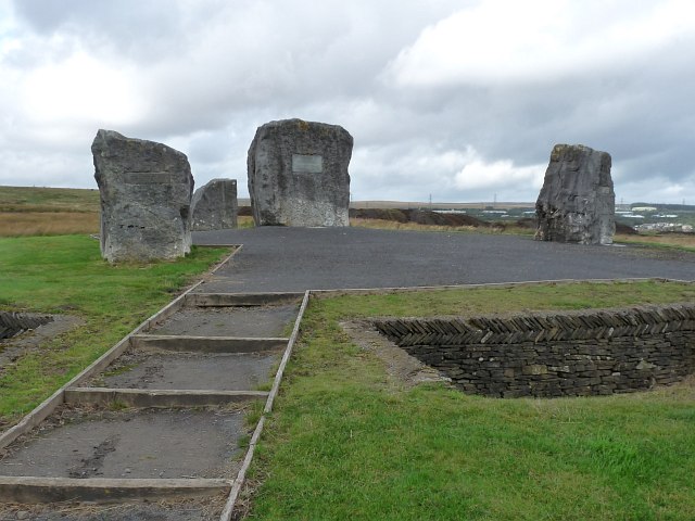
Image: © Robin Drayton Taken: 21 Sep 2011
The centre stone has a plaque http://www.geograph.org.uk/photo/2615739 commemorating that this was the spot where Aneurin Bevan held open air meetings to speak to his constituents. The three other stones point to, and are inscribed with the names of, the three towns in the constituency that he represented in parliament From left to right they are Tredegar, Rhymney and Ebbw Vale. Bevan is best remembered as the architect of the National Health Service which was established in 1948.
Images are licensed for reuse under creativecommons.org/licenses/by-sa/2.0
Image Location
Latitude
51.787321
Longitude
-3.232262