The Fire Research Station (9)
Introduction
The photograph on this page of The Fire Research Station (9) by John Webb as part of the Geograph project.
The Geograph project started in 2005 with the aim of publishing, organising and preserving representative images for every square kilometre of Great Britain, Ireland and the Isle of Man.

There are currently over 7.5m images from over 14,400 individuals and you can help contribute to the project by visiting https://www.geograph.org.uk
The Fire Research Station (9)
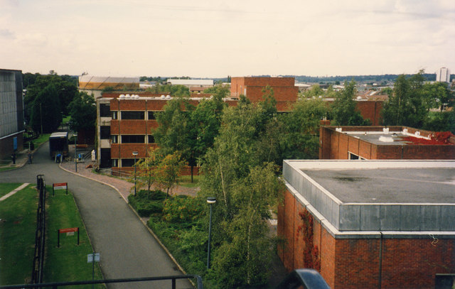
Image: © John Webb Taken: Unknown
View of the Eastern side of the Fire Research Station Site, developed and bought into use in 1978. On the right nearest the camera is the end of the Lecture Theatre, just beyond that is the Publicity/AV/Photography building, and across the centre lies the Clarke building, the major offices and laboratory complex and named after a former Director. The area nearest the camera was part of a private sports ground, the area beyond the Clarke building disused allotments. Beyond the site left of centre is one of the gasholders in Station Road and on the distant far right is Borehamwood's only tower block. Closer views of the Clarke building at Image and Image The East arm of the present Coleridge Way follows roughly the line of the site road.
Images are licensed for reuse under creativecommons.org/licenses/by-sa/2.0
Image Location
Latitude
51.650398
Longitude
-0.275846