The Fire Research Station (8)
Introduction
The photograph on this page of The Fire Research Station (8) by John Webb as part of the Geograph project.
The Geograph project started in 2005 with the aim of publishing, organising and preserving representative images for every square kilometre of Great Britain, Ireland and the Isle of Man.

There are currently over 7.5m images from over 14,400 individuals and you can help contribute to the project by visiting https://www.geograph.org.uk
The Fire Research Station (8)
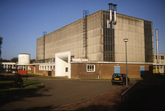
Image: © John Webb Taken: Unknown
A closer view of the Models Laboratory seen in Image; this side lies just within this grid square. From left to right we have the round pump house - an electric 500 gallons/minute pump feeding hoses and hydrants in the Lab - over it is a 5000 gallon water tank feeding the pump. The rest of the single-storey extension housed toilets, instrument and work rooms. Near the camera is the air inlet for the wind area across the end of the building; the single storey extension on the far side houses the electric motor driving the fan and its controls. (The chimney is on a building further away.) The South ends of two of the present blocks of flats in Coleridge Way lie on the area this building once occupied. The East arm of Coleridge Way follows the line of the site road heading off at the right of the picture. (Photo scanned direct from a 35mm Agfa colour slide.)
Images are licensed for reuse under creativecommons.org/licenses/by-sa/2.0
Image Location
Latitude
51.649955
Longitude
-0.276296