Tore Primary School
Introduction
The photograph on this page of Tore Primary School by Richard Dorrell as part of the Geograph project.
The Geograph project started in 2005 with the aim of publishing, organising and preserving representative images for every square kilometre of Great Britain, Ireland and the Isle of Man.

There are currently over 7.5m images from over 14,400 individuals and you can help contribute to the project by visiting https://www.geograph.org.uk
Tore Primary School
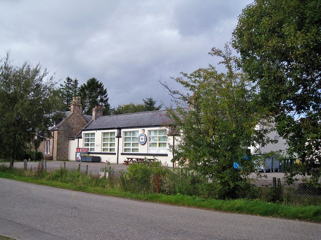
Image: © Richard Dorrell Taken: 20 Sep 2011
The main part of the school is an old building which houses two classrooms, ICT suite, a general purpose room/canteen, kitchen and toilet block. The staff room, office and Meeting/Resource room are now situated in the recently refurbished school house. Another class is situated in a portacabin (not visible in this picture) which is connected to the main part of the school by a corridor.
Images are licensed for reuse under creativecommons.org/licenses/by-sa/2.0
Image Location
Latitude
57.54119
Longitude
-4.343697