Looking down Wakefield Road to the sea
Introduction
The photograph on this page of Looking down Wakefield Road to the sea by Robert Stephenson as part of the Geograph project.
The Geograph project started in 2005 with the aim of publishing, organising and preserving representative images for every square kilometre of Great Britain, Ireland and the Isle of Man.

There are currently over 7.5m images from over 14,400 individuals and you can help contribute to the project by visiting https://www.geograph.org.uk
Looking down Wakefield Road to the sea
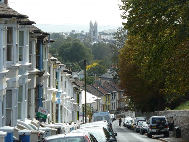
Image: © Robert Stephenson Taken: 19 Sep 2011
A bright September day, the sea just visible as a pale blue strip behind the tower of St Peter's Church, from this chalk ridge above central Brighton. Note the cars parked completely on the pavement - lack of parking a major issue here, even with under half of households having a car.
Images are licensed for reuse under creativecommons.org/licenses/by-sa/2.0
Image Location
Latitude
50.835044
Longitude
-0.130957