Ince St. Mary's CofE Controlled School
Introduction
The photograph on this page of Ince St. Mary's CofE Controlled School by David Long as part of the Geograph project.
The Geograph project started in 2005 with the aim of publishing, organising and preserving representative images for every square kilometre of Great Britain, Ireland and the Isle of Man.

There are currently over 7.5m images from over 14,400 individuals and you can help contribute to the project by visiting https://www.geograph.org.uk
Ince St. Mary's CofE Controlled School
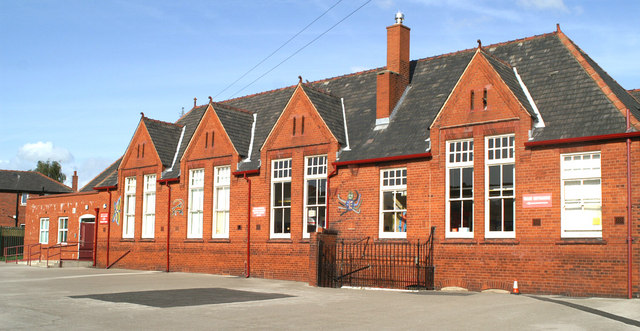
Image: © David Long Taken: 18 Sep 2006
This building was built in 1906, so celebrates its centenary this year (2006). It was built as an all-age (5-14) School by Ince Urban District Council, and was known as Spring View School. In the same year a similar School was opened at Britannia Bridge to serve the other end of the district, at Lower Ince. At a point approximately half way between the two was the existing Hall of Ince School, a Church School in the Parish of St. Mary. This was built in 1866 and 1875. In 1974 the School moved out of those buildings and took over the Spring View building.
Images are licensed for reuse under creativecommons.org/licenses/by-sa/2.0
Image Location
Latitude
53.528397
Longitude
-2.610916