Main road through Pontrilas
Introduction
The photograph on this page of Main road through Pontrilas by Jaggery as part of the Geograph project.
The Geograph project started in 2005 with the aim of publishing, organising and preserving representative images for every square kilometre of Great Britain, Ireland and the Isle of Man.

There are currently over 7.5m images from over 14,400 individuals and you can help contribute to the project by visiting https://www.geograph.org.uk
Main road through Pontrilas
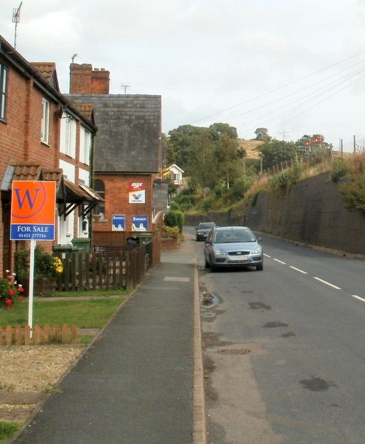
Image: © Jaggery Taken: 6 Sep 2011
There are houses on only one side of the unnamed road through the village in this section. On the other side is the high boundary wall of the Welsh Marches railway line. Visible above the wall, centre right, are two red semaphore signals, controlled by a signal box http://www.geograph.org.uk/photo/2589127 on a small bridge. The white edge of the signal box can be seen in the distance.
Images are licensed for reuse under creativecommons.org/licenses/by-sa/2.0
Image Location
Latitude
51.944537
Longitude
-2.875759