Chapel House, Cropwell Butler
Introduction
The photograph on this page of Chapel House, Cropwell Butler by Alan Murray-Rust as part of the Geograph project.
The Geograph project started in 2005 with the aim of publishing, organising and preserving representative images for every square kilometre of Great Britain, Ireland and the Isle of Man.

There are currently over 7.5m images from over 14,400 individuals and you can help contribute to the project by visiting https://www.geograph.org.uk
Chapel House, Cropwell Butler
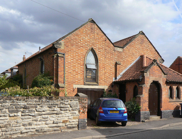
Image: © Alan Murray-Rust Taken: 2 Sep 2011
It was quite difficult to assign a denomination to this former chapel. Although there is an 1845 date stone below the end of the valley gutter, the 1883 1:2500 OS maps does not even identify it as a chapel. The 1900 edition shows it simply as church, the 1919 version labels it Mission Church, and the 1972 version finally shows it as Chapel of St Peter (C of E). It appears that the village never had a proper church, although it nevertheless constitutes a civil parish. I have found information http://southwellchurches.nottingham.ac.uk/tythby/hhistory.php subsequent to writing the above, which confirms that this was built as a chapel of ease within the parish of Tithby, by a local farmer. It closed in 1879, but was reopened in 1897 as St. Peter's Mission Church. It lasted in this form until 1972, since when the function of parish church has reverted to Tithby. United services are now held in the village's Methodist Church.
Images are licensed for reuse under creativecommons.org/licenses/by-sa/2.0
Image Location
Latitude
52.925961
Longitude
-0.982497