Dismantled railway bridge
Introduction
The photograph on this page of Dismantled railway bridge by Eric Jones as part of the Geograph project.
The Geograph project started in 2005 with the aim of publishing, organising and preserving representative images for every square kilometre of Great Britain, Ireland and the Isle of Man.

There are currently over 7.5m images from over 14,400 individuals and you can help contribute to the project by visiting https://www.geograph.org.uk
Dismantled railway bridge
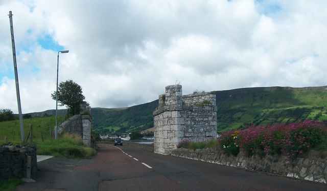
Image: © Eric Jones Taken: 13 Aug 2011
The bridge carried a mineral line across the Garron Road and on to the pier. The short lived line and harbour was built in the 1879s by the Glenariff Iron Ore Mines and Harbour Co, but mining difficulties and the exposed harbour led to bankruptcy. http://en.wikipedia.org/wiki/Glenariff_Iron_Ore_and_Harbour_Company
Images are licensed for reuse under creativecommons.org/licenses/by-sa/2.0
Image Location
Latitude
55.054508
Longitude
-6.035657