The Pennine Way near to Stone Pit Hill, Yorkshire
Introduction
The photograph on this page of The Pennine Way near to Stone Pit Hill, Yorkshire by Dr Neil Clifton as part of the Geograph project.
The Geograph project started in 2005 with the aim of publishing, organising and preserving representative images for every square kilometre of Great Britain, Ireland and the Isle of Man.

There are currently over 7.5m images from over 14,400 individuals and you can help contribute to the project by visiting https://www.geograph.org.uk
The Pennine Way near to Stone Pit Hill, Yorkshire
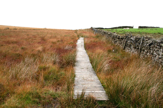
Image: © Dr Neil Clifton Taken: 12 Oct 2006
The Pennine Way walker travelling northwards will be very pleased to know that he is, here, nearly at the end of the peat 'groughs' which have plagued him almost since the start. Far more pleasant limestone country will soon await him. On a short section here, a boardwalk has thoughtfully been provided to bridge a particularly boggy stretch.
Images are licensed for reuse under creativecommons.org/licenses/by-sa/2.0
Image Location


Leaflet Map data © OpenStreetMap
Latitude
53.927181
Longitude
-2.10961