Sandgate, Castle Road
Introduction
The photograph on this page of Sandgate, Castle Road by Helmut Zozmann as part of the Geograph project.
The Geograph project started in 2005 with the aim of publishing, organising and preserving representative images for every square kilometre of Great Britain, Ireland and the Isle of Man.

There are currently over 7.5m images from over 14,400 individuals and you can help contribute to the project by visiting https://www.geograph.org.uk
Sandgate, Castle Road
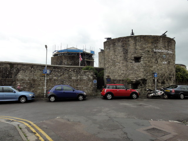
Image: © Helmut Zozmann Taken: 21 Jul 2011
Folkestone, Sandgate, Castle Road, Sandgate Castle. Sandgate Castle is a coastal castle and was originally built as an artillery castle in 1539-1540 by Henry VIII of England as part of his chain of coastal defences in response to the threat of invasion. As these forts were devised by Henry VIII, they are known as Device Forts. It was built to defend a vulnerable stretch of coastline and due to its proximity to the French coast the site has been constantly defended and refortified.
Images are licensed for reuse under creativecommons.org/licenses/by-sa/2.0
Image Location
Latitude
51.073677
Longitude
1.148806