Leopold Street, Long Eaton
Introduction
The photograph on this page of Leopold Street, Long Eaton by Ashley Dace as part of the Geograph project.
The Geograph project started in 2005 with the aim of publishing, organising and preserving representative images for every square kilometre of Great Britain, Ireland and the Isle of Man.

There are currently over 7.5m images from over 14,400 individuals and you can help contribute to the project by visiting https://www.geograph.org.uk
Leopold Street, Long Eaton
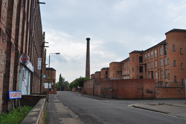
Image: © Ashley Dace Taken: 7 May 2011
Home to a set of former tenement lace factories that are well preserved. On the left are West end and Whiteley's Mills and the chimney is that of Harrington Mills. Image]
Images are licensed for reuse under creativecommons.org/licenses/by-sa/2.0
Image Location
Latitude
52.898177
Longitude
-1.276155