
Seafront Gun Emplacement
Introduction
The photograph on this page of Seafront Gun Emplacement by Glyn Baker as part of the Geograph project.
The Geograph project started in 2005 with the aim of publishing, organising and preserving representative images for every square kilometre of Great Britain, Ireland and the Isle of Man.

There are currently over 7.5m images from over 14,400 individuals and you can help contribute to the project by visiting https://www.geograph.org.uk
Seafront Gun Emplacement
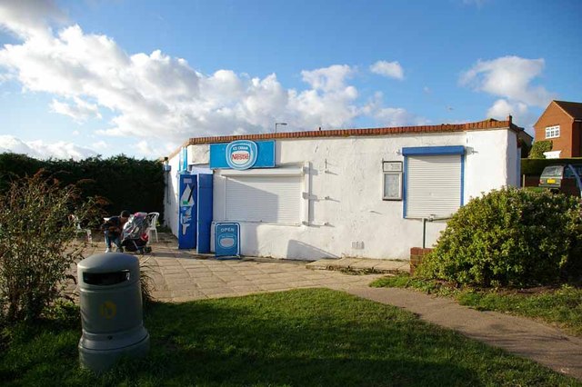
Image: © Glyn Baker Taken: 21 Jan 2007
This Café is built in a WW2 gun emplacement. Until the early 1970's there were two at this point, the other was converted into a rain shelter. It became rather insanitary despite a public convenience a few yards away and so demolition ensued. Buses stopped terminating on the Esplanade in the 1950's for fear of them causing subsidence into the soldiers dormitories under the road. There is another closer view at Image
Images are licensed for reuse under creativecommons.org/licenses/by-sa/2.0
Image Location

Latitude
51.773639
Longitude
0.926069