High Level Bridge Mark
Introduction
The photograph on this page of High Level Bridge Mark by Roger W Haworth as part of the Geograph project.
The Geograph project started in 2005 with the aim of publishing, organising and preserving representative images for every square kilometre of Great Britain, Ireland and the Isle of Man.

There are currently over 7.5m images from over 14,400 individuals and you can help contribute to the project by visiting https://www.geograph.org.uk
High Level Bridge Mark
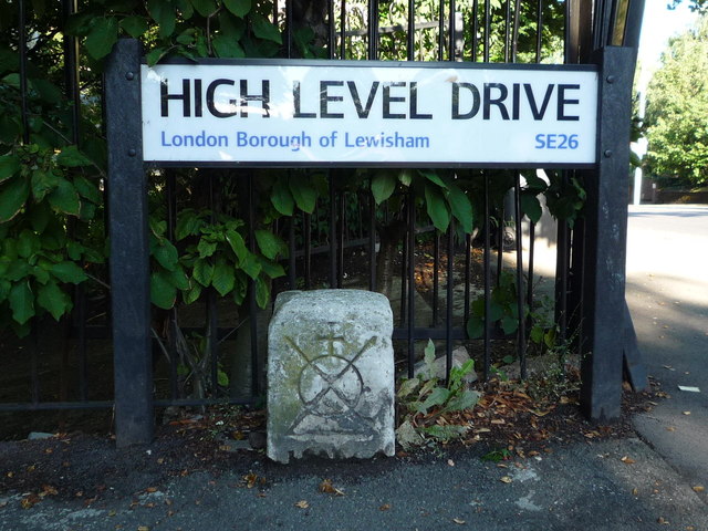
Image: © Roger W Haworth Taken: 20 Aug 2011
High Level Drive, SE26 street name at the junction with Westwood Hill. This was probably the vehicular entrance to Upper Sydenham railway station (Image). Confusingly, Crystal Palace High Level railway station (Image) was about a kilometre away to the southwest. Wikipedia on the railway line: http://en.wikipedia.org/wiki/Crystal_Palace_and_South_London_Junction_Railway . The boundary stone below it bears the Bridge Mark http://en.wikipedia.org/wiki/Bridge_House_Estates#Logo , the logo of Bridge House Estates, a charitable trust originally established to maintain the bridges in the City of London. Clearly near here is part of the Trust's extensive property portfolio. The stone may well be 300 years old.
Images are licensed for reuse under creativecommons.org/licenses/by-sa/2.0
Image Location
Latitude
51.426422
Longitude
-0.069671