Steps down to Cwmbran canal tunnel
Introduction
The photograph on this page of Steps down to Cwmbran canal tunnel by Jaggery as part of the Geograph project.
The Geograph project started in 2005 with the aim of publishing, organising and preserving representative images for every square kilometre of Great Britain, Ireland and the Isle of Man.

There are currently over 7.5m images from over 14,400 individuals and you can help contribute to the project by visiting https://www.geograph.org.uk
Steps down to Cwmbran canal tunnel
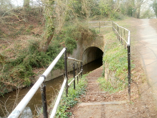
Image: © Jaggery Taken: 26 Mar 2011
Steps descend to the SW portal of the tunnel, which conveys the disused Monmouthshire & Brecon canal for 87 yards (80m). http://www.geograph.org.uk/photo/2572858 to the other end of the tunnel. The location is roughly midway between Cwmbran and Pontypool.
Images are licensed for reuse under creativecommons.org/licenses/by-sa/2.0
Image Location
Latitude
51.66993
Longitude
-3.032409