Bramall Hall
Introduction
The photograph on this page of Bramall Hall by David Dixon as part of the Geograph project.
The Geograph project started in 2005 with the aim of publishing, organising and preserving representative images for every square kilometre of Great Britain, Ireland and the Isle of Man.

There are currently over 7.5m images from over 14,400 individuals and you can help contribute to the project by visiting https://www.geograph.org.uk
Bramall Hall
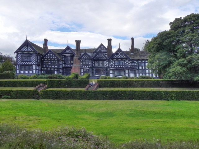
Image: © David Dixon Taken: 24 Aug 2011
The east side of Bramall Hall. Bramall Hall is a Tudor manor house in Bramhall. It is a timber-framed building, the oldest parts of which date from the 14th century, with later additions from the 16th and 19th centuries. The house, which functions as a museum, and its 70 acres of parkland with lakes, woodland, and gardens are open to the public and are run by Stockport MBC. (http://en.wikipedia.org/wiki/Bramall_Hall - Wikipedia) The Hall, which was described by Nicolas Pevsner as ‘one of the four best surviving timber-framed mansions of England’ http://www.stockport.gov.uk/services/business/regeneration/consheritage/conservationareas/bramhallpark , is a Grade I listed building of special architectural and historic interest. http://www.bramallhall.org.uk/ - Bramall Hall web site http://www.stockport.gov.uk/services/business/regeneration/consheritage/conservationareas/bramhallpark - Stockport MBC, Bramhall Park Although the house and the park are officially known by the name "Bramall", there remains confusion over spelling, most often with the house being referred to as "Bramhall", the name of the village in which Bramall Hall is situated.
Images are licensed for reuse under creativecommons.org/licenses/by-sa/2.0
Image Location
Latitude
53.373892
Longitude
-2.166499