Sign for The Moss
Introduction
The photograph on this page of Sign for The Moss by Jonathan Kington as part of the Geograph project.
The Geograph project started in 2005 with the aim of publishing, organising and preserving representative images for every square kilometre of Great Britain, Ireland and the Isle of Man.

There are currently over 7.5m images from over 14,400 individuals and you can help contribute to the project by visiting https://www.geograph.org.uk
Sign for The Moss
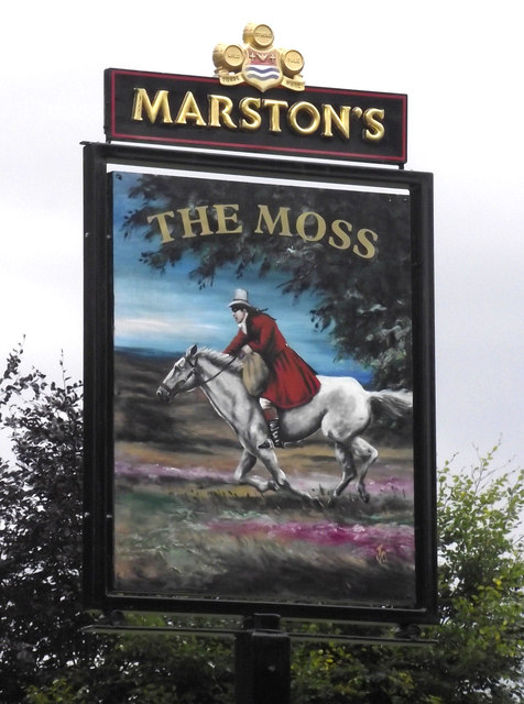
Image: © Jonathan Kington Taken: 21 Aug 2011
Located by the entrance to the car-park for Image, the sign depicts a highwayman galloping across heather moorland. According to David Iredale in "A History of Congleton", Edited by W. B. Stephens ( http://tinyurl.com/3g69jom ), in the 18th century this area was a wilderness of moorland and common pasture land. These common lands provided a useful supply of timber and grazing for animals, they also provided a good area for highwaymen and vagabonds to hide in.
Images are licensed for reuse under creativecommons.org/licenses/by-sa/2.0
Image Location
Latitude
53.154696
Longitude
-2.198996