Plan of the original Priory, Old Malton
Introduction
The photograph on this page of Plan of the original Priory, Old Malton by Pauline E as part of the Geograph project.
The Geograph project started in 2005 with the aim of publishing, organising and preserving representative images for every square kilometre of Great Britain, Ireland and the Isle of Man.

There are currently over 7.5m images from over 14,400 individuals and you can help contribute to the project by visiting https://www.geograph.org.uk
Plan of the original Priory, Old Malton
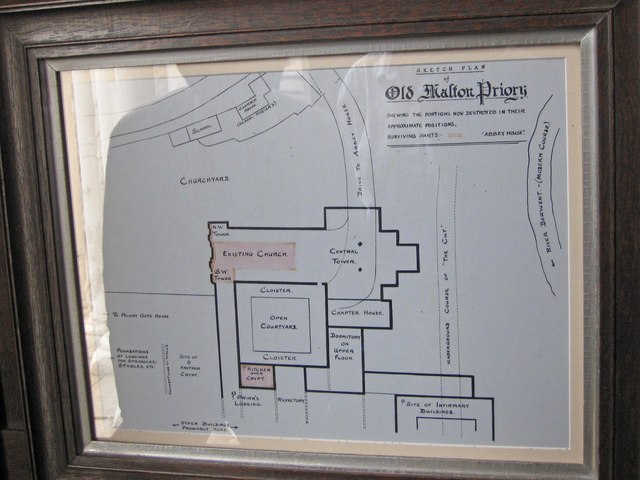
Image: © Pauline E Taken: 25 Aug 2011
The existing church is marked in red. When you look at the church from the outside, Image] you can see how vast the priory was in its heyday.
Images are licensed for reuse under creativecommons.org/licenses/by-sa/2.0
Image Location
Latitude
54.1425
Longitude
-0.779315