Looking up Granny Weavings Lane
Introduction
The photograph on this page of Looking up Granny Weavings Lane by Eric Soons as part of the Geograph project.
The Geograph project started in 2005 with the aim of publishing, organising and preserving representative images for every square kilometre of Great Britain, Ireland and the Isle of Man.

There are currently over 7.5m images from over 14,400 individuals and you can help contribute to the project by visiting https://www.geograph.org.uk
Looking up Granny Weavings Lane
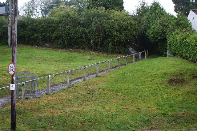
Image: © Eric Soons Taken: 22 Aug 2011
Standing in Tramway Road looking up Granny Weavings Lane (with Grindles Lane running to the left this side of the hedge). Granny Weavings Lane gets steeper yet and at the top forms the link to the two, otherwise disconnected, portions of Bucskhaft Road ... one of the few roads that is metalled, becomes a hand-railed footpath and then re-invents itself as a rough tarmac/gravel single track road. You will see that it is 'No Cycling' down this somewhat steep footpath.
Images are licensed for reuse under creativecommons.org/licenses/by-sa/2.0
Image Location
Latitude
51.801316
Longitude
-2.507669