Talbot Woods: flooding on Talbot Avenue Roundabout
Introduction
The photograph on this page of Talbot Woods: flooding on Talbot Avenue Roundabout by Chris Downer as part of the Geograph project.
The Geograph project started in 2005 with the aim of publishing, organising and preserving representative images for every square kilometre of Great Britain, Ireland and the Isle of Man.

There are currently over 7.5m images from over 14,400 individuals and you can help contribute to the project by visiting https://www.geograph.org.uk
Talbot Woods: flooding on Talbot Avenue Roundabout
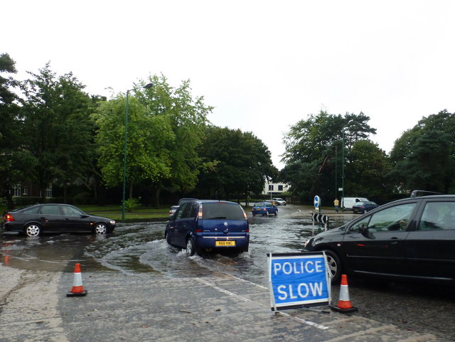
Image: © Chris Downer Taken: 18 Aug 2011
Torrential rain this morning brought chaos to Bournemouth town centre and pockets of inconvenience all across the conurbation. Here we see flash flooding on Talbot Road Roundabout, which is set on such a slope that only one quarter is really affected. Already as we look at it here, the water has begun to recede and it would be clear by teatime when I next came through.
Images are licensed for reuse under creativecommons.org/licenses/by-sa/2.0
Image Location
Latitude
50.740157
Longitude
-1.888558