Bricked Up Gateway
Introduction
The photograph on this page of Bricked Up Gateway by Mr M Evison as part of the Geograph project.
The Geograph project started in 2005 with the aim of publishing, organising and preserving representative images for every square kilometre of Great Britain, Ireland and the Isle of Man.

There are currently over 7.5m images from over 14,400 individuals and you can help contribute to the project by visiting https://www.geograph.org.uk
Bricked Up Gateway
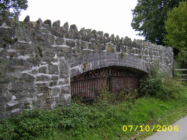
Image: © Mr M Evison Taken: 7 Oct 2006
The Vyrnwy Aqueduct pipelines runs below here. Above the archway is the old trackbed of the long dismantled Tanat Valley Light Railway built in 1904. It was a condition of the line's construction that this access culvert be built under the railway to facilitate repairs to the existing pipeline & also enable the laying of the planned additional pipeline within a few years. Thanks to John Robertson for this information
Images are licensed for reuse under creativecommons.org/licenses/by-sa/2.0
Image Location
Latitude
52.812951
Longitude
-3.359002