Barnton - Saltersford Locks
Introduction
The photograph on this page of Barnton - Saltersford Locks by Mike Harris as part of the Geograph project.
The Geograph project started in 2005 with the aim of publishing, organising and preserving representative images for every square kilometre of Great Britain, Ireland and the Isle of Man.

There are currently over 7.5m images from over 14,400 individuals and you can help contribute to the project by visiting https://www.geograph.org.uk
Barnton - Saltersford Locks
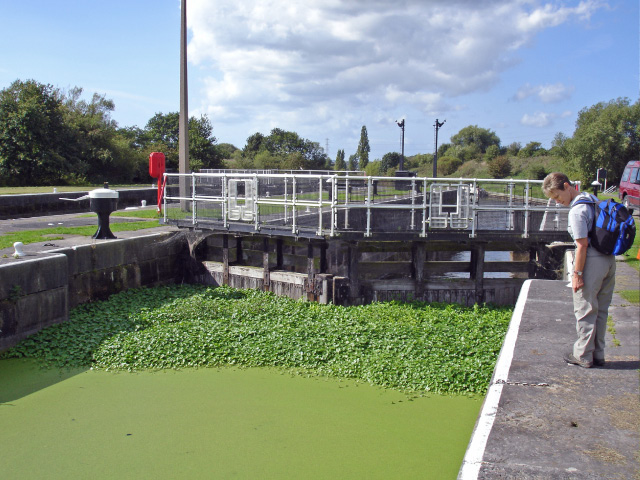
Image: © Mike Harris Taken: 19 Sep 2006
Barnton - Saltersford Locks. Once a busy commercial waterway, the Weaver Navigation (the canalised River Weaver) now has only leisure traffic and the occasional barge or larger ship. Thus one of the twin locks is - obviously from the picture - little used. View is looking downstream towards Acton Bridge.
Images are licensed for reuse under creativecommons.org/licenses/by-sa/2.0
Image Location


Leaflet Map data © OpenStreetMap
Latitude
53.27192
Longitude
-2.561967