Sluice
Introduction
The photograph on this page of Sluice by Malcolm Kewn as part of the Geograph project.
The Geograph project started in 2005 with the aim of publishing, organising and preserving representative images for every square kilometre of Great Britain, Ireland and the Isle of Man.

There are currently over 7.5m images from over 14,400 individuals and you can help contribute to the project by visiting https://www.geograph.org.uk
Sluice
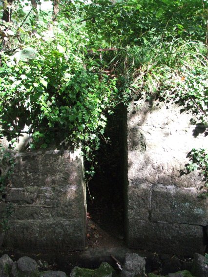
Image: © Malcolm Kewn Taken: 4 Oct 2006
Remains of a sluice, probably used to regulate the flow of water to the former Chyandour smelter a few hundred yards further down the valley. What's left of the gate mechanism can be seen in the foliage above the masonry.
Images are licensed for reuse under creativecommons.org/licenses/by-sa/2.0
Image Location
Latitude
50.127316
Longitude
-5.533653