Whites County Bridge 1931
Introduction
The photograph on this page of Whites County Bridge 1931 by Alan Murray-Rust as part of the Geograph project.
The Geograph project started in 2005 with the aim of publishing, organising and preserving representative images for every square kilometre of Great Britain, Ireland and the Isle of Man.

There are currently over 7.5m images from over 14,400 individuals and you can help contribute to the project by visiting https://www.geograph.org.uk
Whites County Bridge 1931
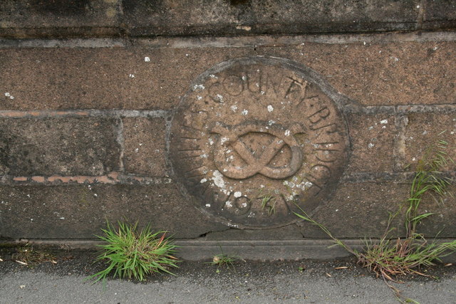
Image: © Alan Murray-Rust Taken: 16 May 2011
Roundel on the parapet of the bridge carrying Macclesfield Road over the River Churnet http://www.geograph.org.uk/photo/2542502. The Staffordshire Knot makes it quite clear which county is involved.
Images are licensed for reuse under creativecommons.org/licenses/by-sa/2.0
Image Location
Latitude
53.111528
Longitude
-2.041788