King Street houses and St Mary's Roman Catholic Church
Introduction
The photograph on this page of King Street houses and St Mary's Roman Catholic Church by Alan Murray-Rust as part of the Geograph project.
The Geograph project started in 2005 with the aim of publishing, organising and preserving representative images for every square kilometre of Great Britain, Ireland and the Isle of Man.

There are currently over 7.5m images from over 14,400 individuals and you can help contribute to the project by visiting https://www.geograph.org.uk
King Street houses and St Mary's Roman Catholic Church
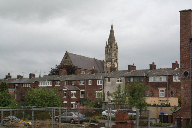
Image: © Alan Murray-Rust Taken: 16 May 2011
This shows the rear of the houses on King Street http://www.geograph.org.uk/photo/2541392 with their weavers' gallery windows. Those to the right are Grade II listed. The church dates from 1886-87, designed by Albert Vicars, and is also Grade II listed.
Images are licensed for reuse under creativecommons.org/licenses/by-sa/2.0
Image Location
Latitude
53.102814
Longitude
-2.026097