Resolven Miners Welfare Public Hall & Institute
Introduction
The photograph on this page of Resolven Miners Welfare Public Hall & Institute by Jaggery as part of the Geograph project.
The Geograph project started in 2005 with the aim of publishing, organising and preserving representative images for every square kilometre of Great Britain, Ireland and the Isle of Man.

There are currently over 7.5m images from over 14,400 individuals and you can help contribute to the project by visiting https://www.geograph.org.uk
Resolven Miners Welfare Public Hall & Institute
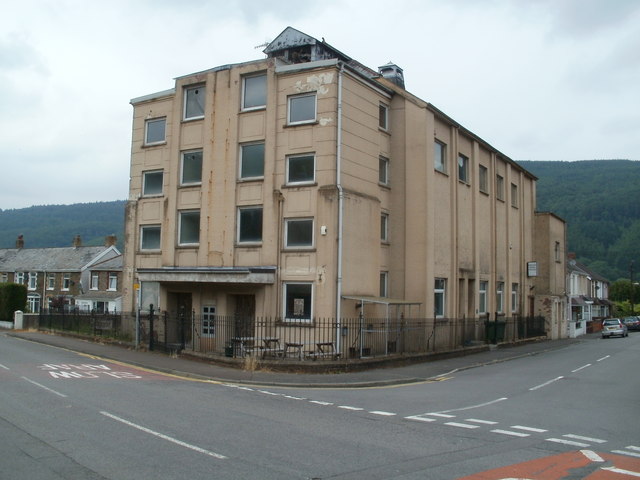
Image: © Jaggery Taken: 31 Jul 2011
This imposing building is on the corner of Neath Road and Coronation Avenue. The site on which the building stands was acquired in 1925. The hall formerly housed a cinema and theatre on the first floor, with performances usually attracting a capacity audience of about 750. The ground floor has had a games room, including billiards and snooker, a reading room and, since the early 1960s, a licensed bar.
Images are licensed for reuse under creativecommons.org/licenses/by-sa/2.0
Image Location
Latitude
51.708956
Longitude
-3.697626