Towednack church
Introduction
The photograph on this page of Towednack church by Graham Horn as part of the Geograph project.
The Geograph project started in 2005 with the aim of publishing, organising and preserving representative images for every square kilometre of Great Britain, Ireland and the Isle of Man.

There are currently over 7.5m images from over 14,400 individuals and you can help contribute to the project by visiting https://www.geograph.org.uk
Towednack church
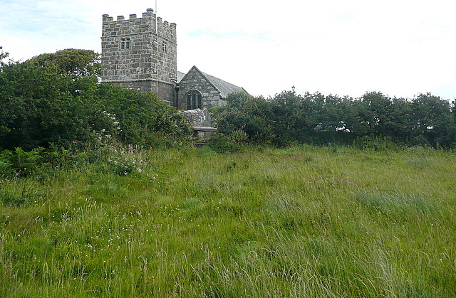
Image: © Graham Horn Taken: 6 Jul 2011
Dedicated to St Winwaloe, a 6th century Breton saint. The church is thought to have been built on the site of a Celtic hermitage. Of particular note is the stumpy tower, built in 1500, although the church has Norman origins. See http://www.towednackchurch.org.uk/ for more information. This is the view from the west, approaching on a footpath. The church is some distance from Nancledra, the main village that it serves.
Images are licensed for reuse under creativecommons.org/licenses/by-sa/2.0
Image Location
Latitude
50.189293
Longitude
-5.522115