View under a footbridge at Oakleigh Park station
Introduction
The photograph on this page of View under a footbridge at Oakleigh Park station by Marathon as part of the Geograph project.
The Geograph project started in 2005 with the aim of publishing, organising and preserving representative images for every square kilometre of Great Britain, Ireland and the Isle of Man.

There are currently over 7.5m images from over 14,400 individuals and you can help contribute to the project by visiting https://www.geograph.org.uk
View under a footbridge at Oakleigh Park station
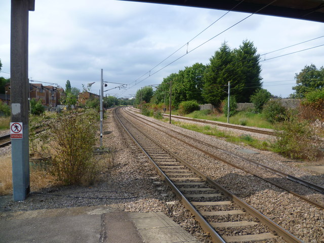
Image: © Marathon Taken: 29 Jul 2011
Looking northwards towards New Barnet, the two middle tracks carry high speed trains, whilst stopping trains use the tracks to the left and the right. The Great Northern Railway opened its line between Maiden Lane and Peterborough through what is now Oakleigh Park in 1850. In 1866 the Whetstone Park Company, promoters of the Whetstone Park Estate, reached an agreement with the Great Northern Railway to construct a new station to serve the development. The station, which was to be known as Whetstone, would open once 25 houses were complete, although the GNR built the two station platforms in anticipation straight away. By summer 1871, the development had been renamed the Oakleigh Park Estate, but not until January 1873 was the developer able to inform the GNR that the 25th house was complete. Accordingly, the GNR authorised the station, now to be known as Oakleigh Park, to be completed. It opened to passenger traffic on 1st December 1873. As part of works to increase the number of tracks from two to four, the station was completely rebuilt in 1891/2 with two island platforms, a new footbridge and booking office.
Images are licensed for reuse under creativecommons.org/licenses/by-sa/2.0
Image Location
Latitude
51.638867
Longitude
-0.167607