Bryn Teg
Introduction
The photograph on this page of Bryn Teg by Graham Burnett as part of the Geograph project.
The Geograph project started in 2005 with the aim of publishing, organising and preserving representative images for every square kilometre of Great Britain, Ireland and the Isle of Man.

There are currently over 7.5m images from over 14,400 individuals and you can help contribute to the project by visiting https://www.geograph.org.uk
Bryn Teg
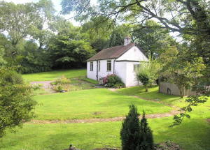
Image: © Graham Burnett Taken: 31 May 2005
Head of Cae Rhug Lane ( once with its own lead mine)
Images are licensed for reuse under creativecommons.org/licenses/by-sa/2.0
Image Location


Leaflet Map data © OpenStreetMap
Latitude
53.174301
Longitude
-3.195344