The Romano British Bath House (under cover)
Introduction
The photograph on this page of The Romano British Bath House (under cover) by David Anstiss as part of the Geograph project.
The Geograph project started in 2005 with the aim of publishing, organising and preserving representative images for every square kilometre of Great Britain, Ireland and the Isle of Man.

There are currently over 7.5m images from over 14,400 individuals and you can help contribute to the project by visiting https://www.geograph.org.uk
The Romano British Bath House (under cover)
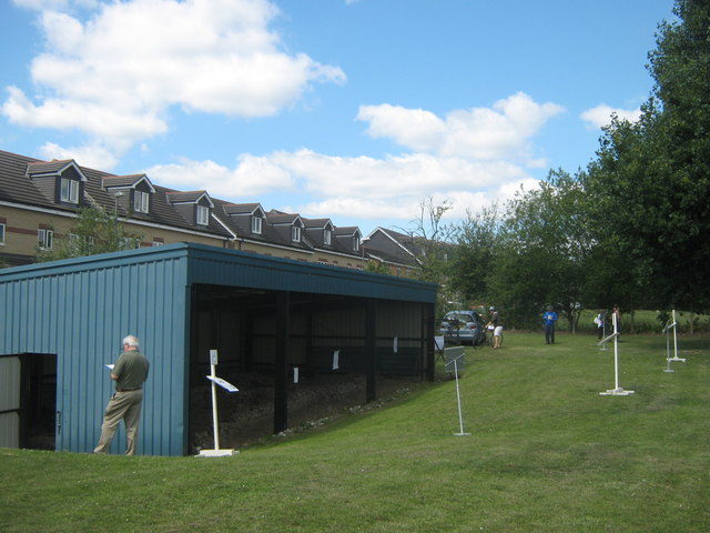
Image: © David Anstiss Taken: 24 Jul 2011
This metal shelter protects a few walls and floor of a small bath house on Poverest Road. The shelter was placed over the remains by Bromley Museum Service and Orpington and District Archaeological Society. This Sunday they had an open day to let visitors see the remains and other information about the society. The white posts have display boards with information about the bath house.
Images are licensed for reuse under creativecommons.org/licenses/by-sa/2.0
Image Location
Latitude
51.388289
Longitude
0.107955