High Street, Dunkeld
Introduction
The photograph on this page of High Street, Dunkeld by P L Chadwick as part of the Geograph project.
The Geograph project started in 2005 with the aim of publishing, organising and preserving representative images for every square kilometre of Great Britain, Ireland and the Isle of Man.

There are currently over 7.5m images from over 14,400 individuals and you can help contribute to the project by visiting https://www.geograph.org.uk
High Street, Dunkeld
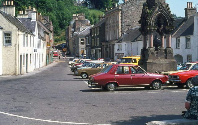
Image: © P L Chadwick Taken: Unknown
This photograph was taken in July 1977. At that time, there were car parking bays immediately adjacent to the Atholl Memorial Fountain, part of which can be seen in this view. Many years later these were removed, and today the fountain is surrounded by a paved area. Apart from that, not a lot has changed, and Dunkeld remains one of Scotland's most complete 18th century country towns.
Images are licensed for reuse under creativecommons.org/licenses/by-sa/2.0
Image Location
Latitude
56.565399
Longitude
-3.586395