Towards Fisherton
Introduction
The photograph on this page of Towards Fisherton by Mary and Angus Hogg as part of the Geograph project.
The Geograph project started in 2005 with the aim of publishing, organising and preserving representative images for every square kilometre of Great Britain, Ireland and the Isle of Man.

There are currently over 7.5m images from over 14,400 individuals and you can help contribute to the project by visiting https://www.geograph.org.uk
Towards Fisherton
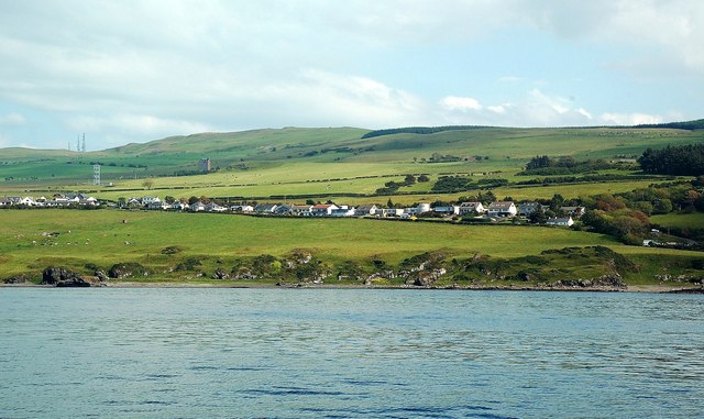
Image: © Mary and Angus Hogg Taken: 3 Jul 2011
The road connecting Fisherton with Dunure, viewed from the Paddle Steamer "Waverley" on its early July sailing to Ailsa Craig. Fisherton is the cluster of buildings on the far left, with the GPO communication mast further inland. The 3 police radio masts on the skyline, a prominent local landmark, are on Brown Carrick Hill. Recently restored Dunduff Castle is shown on the lower slopes facing the Firth of Clyde. Most of the large houses on the connecting road were built by local fishermen in their industry's 20th century boom years.
Images are licensed for reuse under creativecommons.org/licenses/by-sa/2.0
Image Location
Latitude
55.410599
Longitude
-4.752122