Fuller's Brewery
Introduction
The photograph on this page of Fuller's Brewery by Rod Allday as part of the Geograph project.
The Geograph project started in 2005 with the aim of publishing, organising and preserving representative images for every square kilometre of Great Britain, Ireland and the Isle of Man.

There are currently over 7.5m images from over 14,400 individuals and you can help contribute to the project by visiting https://www.geograph.org.uk
Fuller's Brewery
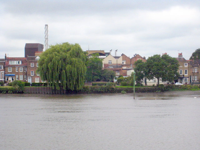
Image: © Rod Allday Taken: 25 Jun 2011
Users of the A4 at Chiswick's Hogarth roundabout will be familiar with the brewery which stands on the roundabout but this will no doubt be a less familiar view, seen from the south side of the Thames.
Images are licensed for reuse under creativecommons.org/licenses/by-sa/2.0
Image Location
Latitude
51.486806
Longitude
-0.250048