Brucehill Cliffs and Havoc Grassland
Introduction
The photograph on this page of Brucehill Cliffs and Havoc Grassland by Lairich Rig as part of the Geograph project.
The Geograph project started in 2005 with the aim of publishing, organising and preserving representative images for every square kilometre of Great Britain, Ireland and the Isle of Man.

There are currently over 7.5m images from over 14,400 individuals and you can help contribute to the project by visiting https://www.geograph.org.uk
Brucehill Cliffs and Havoc Grassland
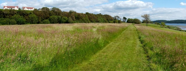
Image: © Lairich Rig Taken: 1 Jul 2011
Section 17 of the book "Wildlife Around Glasgow" (2010, Richard Sutcliffe) is devoted to Brucehill Cliffs and Havoc Grassland. The book notes that the site is designated a Local Nature Conservation Site and proposed as a Local Nature Reserve. The area is a raised beach, with former sea-cliffs of red sandstone (visible to the left, among the trees). The Image can be seen at the north-western end of the line of cliffs, beside Image The grassland, which is of recent origin, is rich in orchids and other flowers. The cliffs support their own distinctive species; see, for example, Image At the extreme right is the River Clyde; Image follows the head of the beach. See Image for a view of the same area from higher up.
Images are licensed for reuse under creativecommons.org/licenses/by-sa/2.0
Image Location
Latitude
55.94273
Longitude
-4.591165