Old road sign at bottom of Baildon Road
Introduction
The photograph on this page of Old road sign at bottom of Baildon Road by David Spencer as part of the Geograph project.
The Geograph project started in 2005 with the aim of publishing, organising and preserving representative images for every square kilometre of Great Britain, Ireland and the Isle of Man.

There are currently over 7.5m images from over 14,400 individuals and you can help contribute to the project by visiting https://www.geograph.org.uk
Old road sign at bottom of Baildon Road
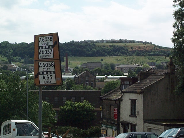
Image: © David Spencer Taken: 8 Jul 2005
This is a 'Pre Worboys' road sign giving directions for traffic leaving Baildon Road and going sharp left towards Otley or bearing right towards Shipley. View of Wrose Hill behind.
Images are licensed for reuse under creativecommons.org/licenses/by-sa/2.0
Image Location


Leaflet Map data © OpenStreetMap
Latitude
53.840815
Longitude
-1.7686