Gouthwaite Reservoir
Introduction
The photograph on this page of Gouthwaite Reservoir by Derek Harper as part of the Geograph project.
The Geograph project started in 2005 with the aim of publishing, organising and preserving representative images for every square kilometre of Great Britain, Ireland and the Isle of Man.

There are currently over 7.5m images from over 14,400 individuals and you can help contribute to the project by visiting https://www.geograph.org.uk
Gouthwaite Reservoir
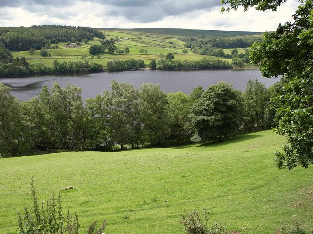
Image: © Derek Harper Taken: 26 Jun 2011
Seen from the Nidderdale Way across a sloping field of grass. On the far side are West Wood House (with West Wood behind) and Eanings left of centre, while to the right, Burn Gill drops down a wooded valley. Behind rises Heathfield Moor.
Images are licensed for reuse under creativecommons.org/licenses/by-sa/2.0
Image Location


Leaflet Map data © OpenStreetMap
Latitude
54.110407
Longitude
-1.796532