Maypole, Sturminster Marshall
Introduction
The photograph on this page of Maypole, Sturminster Marshall by Maigheach-gheal as part of the Geograph project.
The Geograph project started in 2005 with the aim of publishing, organising and preserving representative images for every square kilometre of Great Britain, Ireland and the Isle of Man.

There are currently over 7.5m images from over 14,400 individuals and you can help contribute to the project by visiting https://www.geograph.org.uk
Maypole, Sturminster Marshall
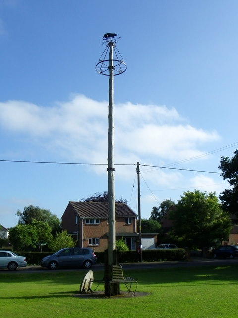
Image: © Maigheach-gheal Taken: 25 Jun 2011
The first maypole was erected in 1101 after permission for a fair had been granted by the Lord of the Manor, the Earl of Pembroke. Restorations are known to have taken place in 1669, 1857 and 1897 and the present pole follows the 1897 design. The 1986 pole is 35 feet high and is topped by a weather vane designed as a water rat, the village emblem.
Images are licensed for reuse under creativecommons.org/licenses/by-sa/2.0
Image Location
Latitude
50.801156
Longitude
-2.072886