The Civic Offices
Introduction
The photograph on this page of The Civic Offices by Jonathan Kington as part of the Geograph project.
The Geograph project started in 2005 with the aim of publishing, organising and preserving representative images for every square kilometre of Great Britain, Ireland and the Isle of Man.

There are currently over 7.5m images from over 14,400 individuals and you can help contribute to the project by visiting https://www.geograph.org.uk
The Civic Offices
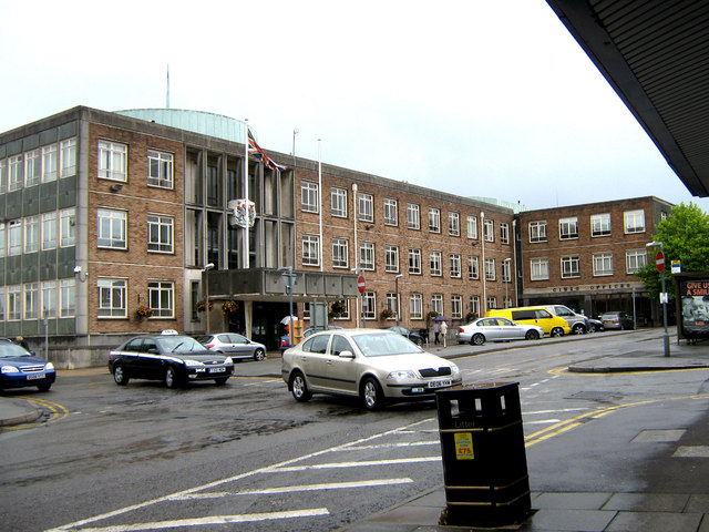
Image: © Jonathan Kington Taken: 21 Jun 2011
This building houses the offices for Newcastle-Under-Lyme town and borough councils. In 1910 nearby Stoke-on-Trent was formed by the amalgamation of six towns (Stoke-Upon-Trent, Hanley, Fenton, Longton, Burslem and Tunstall) but despite many efforts to include Newcastle they remained separate following an overwhelming vote of 97.4% opposing a merger. Following the Local Government Act 1972 it became the Borough of Newcastle-Under-Lyme.
Images are licensed for reuse under creativecommons.org/licenses/by-sa/2.0
Image Location
Latitude
53.012582
Longitude
-2.227614