Former Sundial, Chobham
Introduction
The photograph on this page of Former Sundial, Chobham by Colin Smith as part of the Geograph project.
The Geograph project started in 2005 with the aim of publishing, organising and preserving representative images for every square kilometre of Great Britain, Ireland and the Isle of Man.

There are currently over 7.5m images from over 14,400 individuals and you can help contribute to the project by visiting https://www.geograph.org.uk
Former Sundial, Chobham
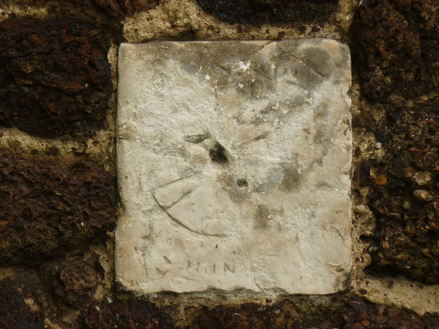
Image: © Colin Smith Taken: 19 Jun 2011
Historic and old stone on the south wall of Chobham's parish church, St Lawrence. The former sundial is now a pale shadow of its former self. Time flies! http://www.chobham.org.uk/
Images are licensed for reuse under creativecommons.org/licenses/by-sa/2.0
Image Location


Leaflet Map data © OpenStreetMap
Latitude
51.346679
Longitude
-0.603171