House in Elers Road
Introduction
The photograph on this page of House in Elers Road by David Smith as part of the Geograph project.
The Geograph project started in 2005 with the aim of publishing, organising and preserving representative images for every square kilometre of Great Britain, Ireland and the Isle of Man.

There are currently over 7.5m images from over 14,400 individuals and you can help contribute to the project by visiting https://www.geograph.org.uk
House in Elers Road
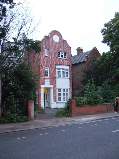
Image: © David Smith Taken: 14 Jun 2011
The house is dated 1898, and shows Dutch influence in the gable.
Images are licensed for reuse under creativecommons.org/licenses/by-sa/2.0
Image Location
Latitude
51.505157
Longitude
-0.311881