Dalmuir Light
Introduction
The photograph on this page of Dalmuir Light by Lairich Rig as part of the Geograph project.
The Geograph project started in 2005 with the aim of publishing, organising and preserving representative images for every square kilometre of Great Britain, Ireland and the Isle of Man.

There are currently over 7.5m images from over 14,400 individuals and you can help contribute to the project by visiting https://www.geograph.org.uk
Dalmuir Light
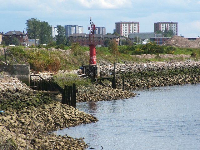
Image: © Lairich Rig Taken: 10 Jun 2011
This old beacon was photographed from a Image (it can be seen, although not very well, in the background of that image); see Image for another view. It is very similar in design to a beacon that stands at Old Kilpatrick; for that beacon, see Image and Image See the last of those links for a reference to their purpose; as noted there, both of the lights date from the nineteenth century, and they mark the location of bends in the river. For more on those lights, see Image, which is also similar in design. [An earlier map, c.1898, does show a "Dalmuir Light (fixed red)", but it was further downriver. However, that map does show another beacon, simply labelled "beacon", very close to the spot where the present Dalmuir Light is located; making allowance for refinements in positioning over the years, it may be the same spot.] Originally (c.1914), the maps show Dalmuir Light as "flashing white"; by the 1960s, it is "flashing red", as at present. It is located on the north bank of the Clyde, between the former sites of two shipyards: Beardmore's, which was downriver, and John Brown's, which was upriver.
Images are licensed for reuse under creativecommons.org/licenses/by-sa/2.0
Image Location
Latitude
55.902762
Longitude
-4.417469