Railway east of Purfleet station
Introduction
The photograph on this page of Railway east of Purfleet station by Robin Webster as part of the Geograph project.
The Geograph project started in 2005 with the aim of publishing, organising and preserving representative images for every square kilometre of Great Britain, Ireland and the Isle of Man.

There are currently over 7.5m images from over 14,400 individuals and you can help contribute to the project by visiting https://www.geograph.org.uk
Railway east of Purfleet station
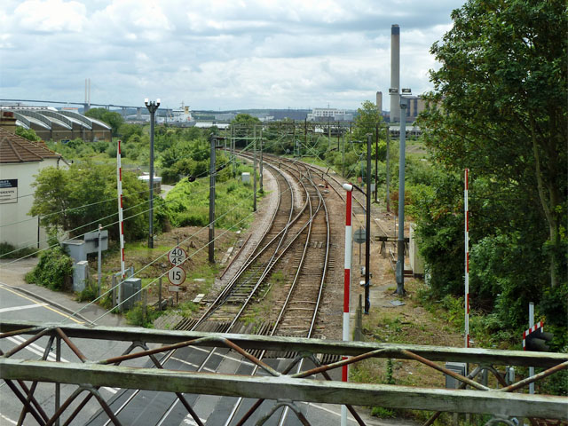
Image: © Robin Webster Taken: 19 Jun 2011
The railway at Purfleet has two quite sharp reverse bends, this is the eastern one, which continues through the station behind the viewpoint. Presumably a route carrying on close to the river on low ground was vetoed because of the military establishment that was here, and so a more inland route was required. The bend away from the river here need not have been that sharp, but the route aligned with an old chalk quarry to minimise the work required to get through the chalk outcrop to the north, and minimising work seemed to be the order of the day.
Images are licensed for reuse under creativecommons.org/licenses/by-sa/2.0
Image Location
Latitude
51.479958
Longitude
0.237335