Quarrywood Road and the Red Road flats
Introduction
The photograph on this page of Quarrywood Road and the Red Road flats by Richard Webb as part of the Geograph project.
The Geograph project started in 2005 with the aim of publishing, organising and preserving representative images for every square kilometre of Great Britain, Ireland and the Isle of Man.

There are currently over 7.5m images from over 14,400 individuals and you can help contribute to the project by visiting https://www.geograph.org.uk
Quarrywood Road and the Red Road flats
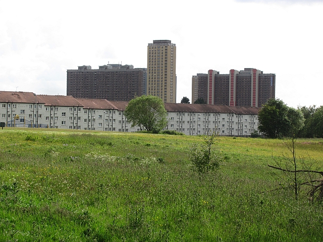
Image: © Richard Webb Taken: 16 Jun 2011
Looking out of Robroyston Park over the houses on Quarrywood Road towards the famous flats on Red Road. This skyline is doomed as the high rise buildings are being demolished.
Images are licensed for reuse under creativecommons.org/licenses/by-sa/2.0
Image Location
Latitude
55.879503
Longitude
-4.205933