Old chimney, Bangor
Introduction
The photograph on this page of Old chimney, Bangor by Albert Bridge as part of the Geograph project.
The Geograph project started in 2005 with the aim of publishing, organising and preserving representative images for every square kilometre of Great Britain, Ireland and the Isle of Man.

There are currently over 7.5m images from over 14,400 individuals and you can help contribute to the project by visiting https://www.geograph.org.uk
Old chimney, Bangor
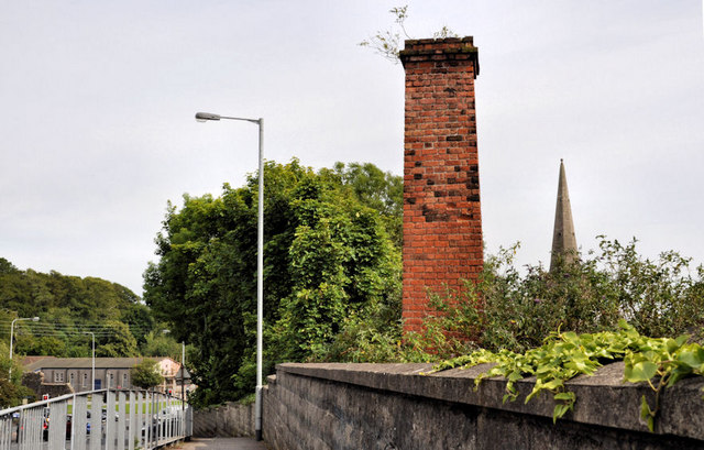
Image: © Albert Bridge Taken: 14 Jun 2011
This is the view, southeast, across the Boyne Bridge on the Brunswick Road. The railway Image is below. Hard to imagine now but the Belfast and County Down railway had an extensive yard on the Belfast side. It included sidings, an engine shed and a sand drier of which this chimney was part. Dry sand was essential in preventing wheel slip. The old engine shed was (if my memory is correct) subsequently occupied by a business, making dog food, which later moved to Castlewellan. Continue to Image (October 2013).
Images are licensed for reuse under creativecommons.org/licenses/by-sa/2.0
Image Location
Latitude
54.656867
Longitude
-5.676138