Boundary markers
Introduction
The photograph on this page of Boundary markers by Michael Fox as part of the Geograph project.
The Geograph project started in 2005 with the aim of publishing, organising and preserving representative images for every square kilometre of Great Britain, Ireland and the Isle of Man.

There are currently over 7.5m images from over 14,400 individuals and you can help contribute to the project by visiting https://www.geograph.org.uk
Boundary markers
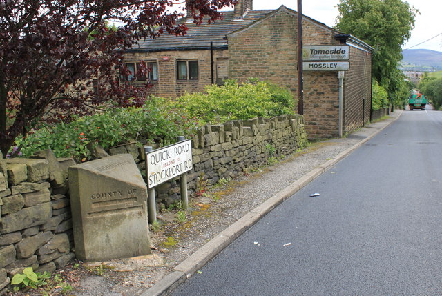
Image: © Michael Fox Taken: 9 Jun 2011
This boundary stone was one of several which Mossley local authority commissioned in 1899; it was deliberately defaced during the 1939 to 1945 war. Behind is the modern sign denoting what is now the boundary between Tameside and Oldham.
Images are licensed for reuse under creativecommons.org/licenses/by-sa/2.0
Image Location
Latitude
53.529773
Longitude
-2.038732