Old lime kiln, Larne
Introduction
The photograph on this page of Old lime kiln, Larne by Albert Bridge as part of the Geograph project.
The Geograph project started in 2005 with the aim of publishing, organising and preserving representative images for every square kilometre of Great Britain, Ireland and the Isle of Man.

There are currently over 7.5m images from over 14,400 individuals and you can help contribute to the project by visiting https://www.geograph.org.uk
Old lime kiln, Larne
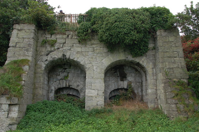
Image: © Albert Bridge Taken: 21 Sep 2006
Limestone is common throughout east Antrim and there were many kilns. This (disused) double kiln is at the northern end of the promenade. On the “At Risk” register.
Images are licensed for reuse under creativecommons.org/licenses/by-sa/2.0
Image Location
Latitude
54.859509
Longitude
-5.812773