The Wesleyan chapel and the castle keep
Introduction
The photograph on this page of The Wesleyan chapel and the castle keep by John S Turner as part of the Geograph project.
The Geograph project started in 2005 with the aim of publishing, organising and preserving representative images for every square kilometre of Great Britain, Ireland and the Isle of Man.

There are currently over 7.5m images from over 14,400 individuals and you can help contribute to the project by visiting https://www.geograph.org.uk
The Wesleyan chapel and the castle keep
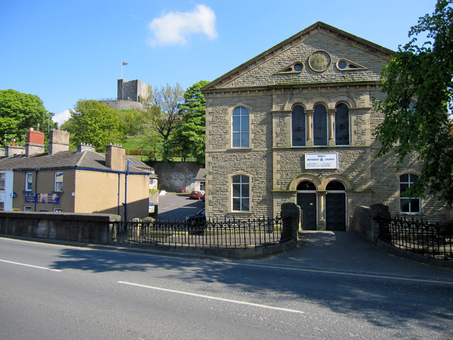
Image: © John S Turner Taken: 28 Apr 2011
Looking across Parson Lane towards the Wesleyan chapel that was built in 1868. The building is now known as the Trinity Methodist church http://www.clitheroemethodistcircuit.co.uk/trinity/index.html The terrace of houses on the left is Wesleyan Row, and the castle keep can be seen high up in the background.
Images are licensed for reuse under creativecommons.org/licenses/by-sa/2.0
Image Location


Leaflet Map data © OpenStreetMap
Latitude
53.870855
Longitude
-2.395376