River Ravensbourne approaching Brookmill Park
Introduction
The photograph on this page of River Ravensbourne approaching Brookmill Park by Marathon as part of the Geograph project.
The Geograph project started in 2005 with the aim of publishing, organising and preserving representative images for every square kilometre of Great Britain, Ireland and the Isle of Man.

There are currently over 7.5m images from over 14,400 individuals and you can help contribute to the project by visiting https://www.geograph.org.uk
River Ravensbourne approaching Brookmill Park
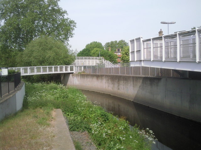
Image: © Marathon Taken: 6 May 2011
The River Ravensbourne used to run in a concrete channel through Brookmill Park but as part of the construction of the Lewisham extension of the Docklands Light Railway in 1999, the river was given a more 'natural' winding course,whilst the DLR used the old course of the river. It was an inspired solution and both the park and the DLR benefited. Brookmill Park has been expanded over the years although some of the park was lost with the DLR extension. This photograph shows part of the old concrete course of the river whilst Brookmill Park is just beyond the footbridge on the left and this is where the diverted section of river starts. The footbridge in the middle of the photograph is over the DLR whilst the bridge on the extreme right leads to Elverson Road DLR station.
Images are licensed for reuse under creativecommons.org/licenses/by-sa/2.0
Image Location
Latitude
51.469158
Longitude
-0.017041