Re-development on Bell Road
Introduction
The photograph on this page of Re-development on Bell Road by David Anstiss as part of the Geograph project.
The Geograph project started in 2005 with the aim of publishing, organising and preserving representative images for every square kilometre of Great Britain, Ireland and the Isle of Man.

There are currently over 7.5m images from over 14,400 individuals and you can help contribute to the project by visiting https://www.geograph.org.uk
Re-development on Bell Road
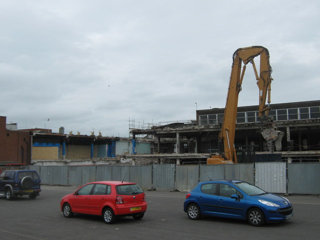
Image: © David Anstiss Taken: 28 May 2011
As seen from the access road to Sainsbury's. This office block (Bell House) is being knocked down from the back. This demolition site also includes Bell Shopping Centre (on the left) which has been mostly empty for many years. Except The Summoner (Wetherspoon Pub) and above, a snooker hall.
Images are licensed for reuse under creativecommons.org/licenses/by-sa/2.0
Image Location
Latitude
51.33863
Longitude
0.738879