Heygate Estate demolition
Introduction
The photograph on this page of Heygate Estate demolition by Malc McDonald as part of the Geograph project.
The Geograph project started in 2005 with the aim of publishing, organising and preserving representative images for every square kilometre of Great Britain, Ireland and the Isle of Man.

There are currently over 7.5m images from over 14,400 individuals and you can help contribute to the project by visiting https://www.geograph.org.uk
Heygate Estate demolition
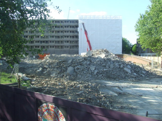
Image: © Malc McDonald Taken: 2 May 2011
The demolition of the Heygate Estate in inner south London is part of a £1.5billion project which will take a number of years to complete. This is the first part of the estate to be demolished, seen from the upper deck of a bus on Rodney Road.
Images are licensed for reuse under creativecommons.org/licenses/by-sa/2.0
Image Location
Latitude
51.492332
Longitude
-0.091233